
1
Stay in Touch
Get the latest updates, special offers, and exclusive Cinchy perks straight to your inbox.

Jl. Plawa No.50, Seminyak, Kec. Kuta, Kabupaten Badung, Bali 80361
CALL US 24/7
(+62-851-7424-6249)
Copied!

We’ll be Back
at
8:30 AM-9 PM WITA


Payment Partners
© 2026 CINCHY. ALL RIGHTS RESERVED.
Cinchy Blog / Your Guide to the Best Navigation Apps for Motorcycling Adventures
Published: 11 Feb 2026

By Ulfah Alifah
Travel Enthusiast
Free Cancellation
24/7 Support
Insurance
Start Date - End Date
Start Time
End Time
Duration
0 Day(s)
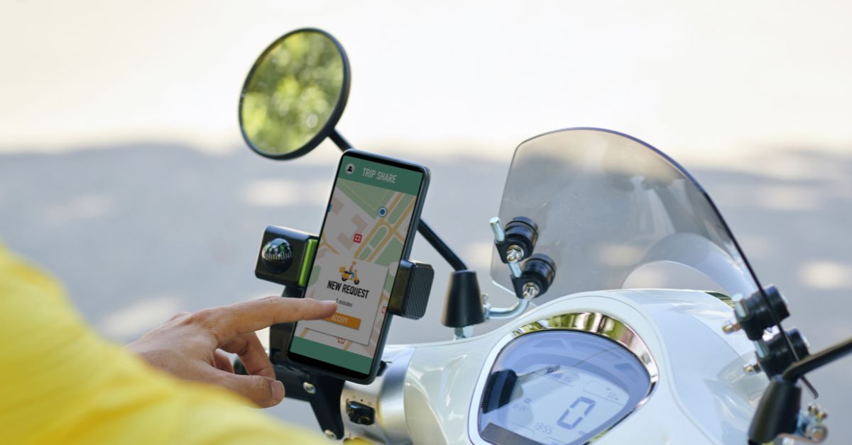
Exploring Bali—or any new destination—on a scooter or motorbike is free, fun, and unforgettable, especially when armed with the right navigation app for safety and efficiency. Whether riding through Seminyak, Uluwatu, Ubud, or Denpasar, choosing the most accurate navigation app can transform a tourist's journey. These apps offer route planning, hazard alerts, community tips, ride tracking, and much more for confident travel on two wheels.
Motorcycle and scooter adventures present unique challenges—complex road networks, sudden turns, changing weather, and tourist-heavy traffic. The right navigation app helps riders avoid dangerous roads, pick scenic routes, and stay safe with live alerts, all through a user-friendly interface. Audio navigation and offline maps are critical when eyes must stay focused and internet service is unreliable.
Motobit stands out in 2025 as one of the most advanced navigation apps for motorcyclists. It was built from the ground up for riders, offering features like:
Motobit has a user-friendly, intuitive layout and gets frequent updates based on user feedback. Its average app store rating is 4.6/5, making it top-rated among its peers.
Calimoto is another favorite, known for its “curviness” algorithm that creates scenic, fun routes tailored to motorbikes:
Calimoto’s interface was redesigned recently but may feel less intuitive to some. The free version covers basic route planning; navigation and tracking are available via a subscription.
Scenic is especially popular with Apple users and features:
The app is praised for its stability and ease of use, but full navigation requires a subscription after the free trial. Map downloads require credits, sold separately.
Kurviger started as a web route planner and is known for its in-depth custom route creation:
While still in active development, the free beta app currently supports detailed trip planning with good offline access. Its strength is versatility for advanced riders, but beginners may find it a bit technical.
Riser is an intuitive, community-driven option:
While advanced features require a subscription, Riser’s core tracking and planning tools are available for free.
Arguably the most reliable all-purpose solution, Google Maps is free, easy to use, and covers nearly every road in Bali and beyond. While it lacks motorbike-specific features like lean-angle analytics, or “curvy road” planning, its strengths include:
For most tourists and new riders, Google Maps is an excellent starting point.
Especially strong for city rides, combining public transport and scooter routes for a seamless urban journey. It includes live ETA, best route suggestions, and real-time service updates.
Ideal for scenery-seekers, this explorer’s app includes:
Combining reliable navigation with a new, secure, and fully insured scooter makes exploring Bali stress-free. With Cinchy:
Choose your navigation app wisely—pair it with a Cinchy motorbike rental to experience Bali with safety and confidence. Whether you’re a casual tourist or a seasoned two-wheeler, these tools will help you make the most of every route.
Ready to ride? Book your scooter now or learn more about exploring Bali with Cinchy here.
Accurate navigation apps for motorcycling tourists combine safety, smart route planning, and travel community insights for memorable journeys. Choose from advanced options like Motobit, feature-rich apps like Calimoto or Scenic, or simple mainstays like Google Maps. Paired with a Cinchy scooter, these apps offer unbeatable precision and ease across Bali and beyond.
