
1
Stay in Touch
Get the latest updates, special offers, and exclusive Cinchy perks straight to your inbox.

Jl. Plawa No.50, Seminyak, Kec. Kuta, Kabupaten Badung, Bali 80361
CALL US 24/7
(+62-851-7424-6249)
Copied!

We’re Here
Everyday
8:30 AM-9 PM WITA


Payment Partners
© 2026 CINCHY. ALL RIGHTS RESERVED.
Cinchy Blog / Bali Volcanoes: The Complete Guide to Active & Dormant Peaks, Heights, and Eruption History
Published: 26 Mar 2026

By Ulfah Alifah
Travel Enthusiast
Free Cancellation
24/7 Support
Insurance
Start Date - End Date
Start Time
End Time
Duration
0 Day(s)
Bali is famous for its beaches and temples — but beneath all of that beauty lies something ancient, powerful, and deeply spiritual: volcanoes.
Bali sits on the Pacific Ring of Fire, a tectonically active belt that wraps around the edges of the Pacific Ocean. This location explains why the island has so many volcanic peaks, both active and dormant. These mountains do more than shape the landscape. They define Balinese culture, religion, and even the layout of homes and temples.
In Balinese Hinduism, volcanoes are sacred dwelling places of the gods. The direction kaja — pointing toward the mountains — is considered the holiest direction on the island. Villages, temples, sleeping areas, and shrines are all oriented in relation to the nearest volcanic peak. Understanding Bali's volcanoes means understanding Bali itself.
Bali's unique spiritual geography is also deeply tied to its social structure. If you want to understand how the island's people live and worship, take a moment to explore our guide to the Balinese caste system and cultural traditions — it puts the sacred role of these mountains into perspective.
Before you set off on your volcanic adventure, it also helps to know what language is spoken in Bali. Knowing a few local phrases goes a long way, especially in highland villages near the volcanic areas.
According to Indonesia's Center for Volcanology and Geological Hazard Mitigation (PVMBG), Bali has two officially active volcanoes: Mount Agung and Mount Batur. Both are continuously monitored for signs of eruption.
🌋 Volcanic Status: Active Stratovolcano
📖 Description
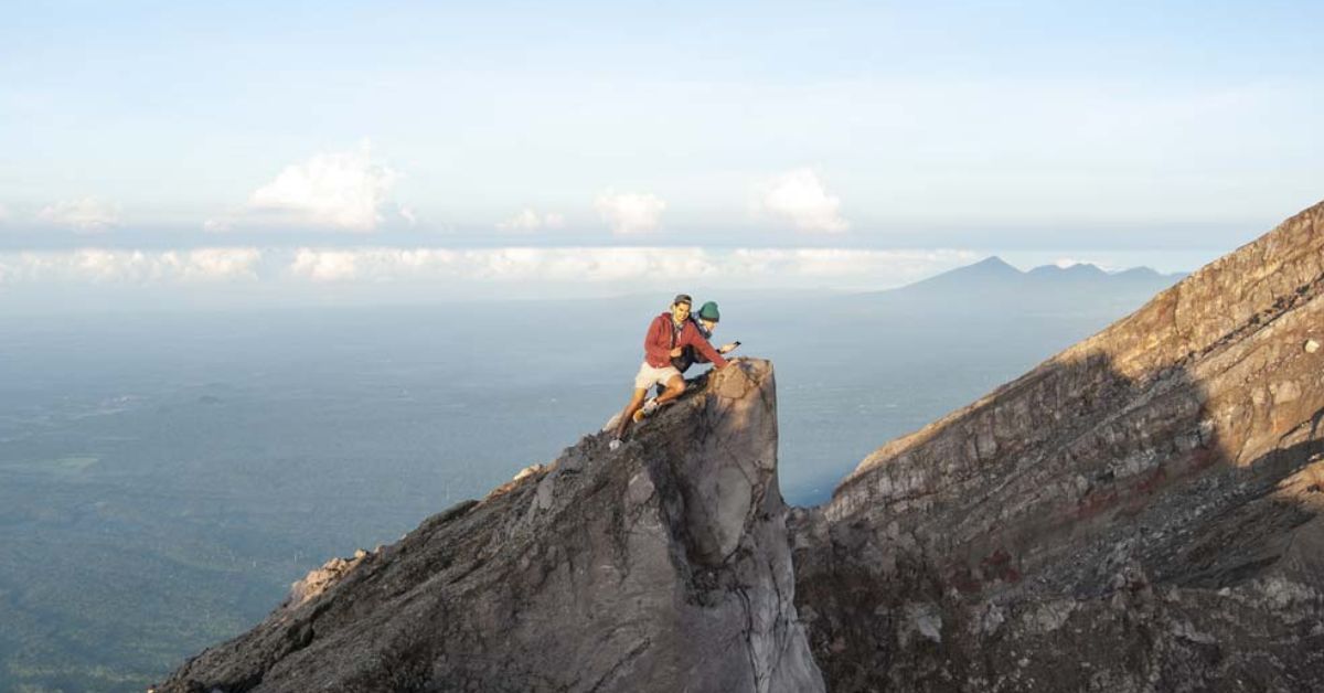
Mount Agung is Bali's highest peak and its most revered mountain. Known locally as Gunung Agung, the name means "Paramount" or "Great Mountain." It towers over the eastern end of the island in the Karangasem Regency and is visible from nearly everywhere on a clear day.
Agung is a classic stratovolcano — built up over thousands of years from alternating layers of hardened lava, volcanic ash, and rocky debris. In Balinese Hindu belief, this mountain is considered the seat of the gods, particularly Batara Guru (a manifestation of Lord Shiva). The entire island's spiritual compass is oriented toward its summit. For the Balinese, Agung is not just a mountain. It is a living, breathing deity.
📏 Height: 3,148 meters (10,308 feet) above sea level — Bali's highest point.
🕳️ Crater: The summit crater sits on the eastern side of the peak and measures approximately 700 meters wide. It regularly releases volcanic gases and steam, a visible reminder that the mountain remains active.
📐 Base Width: The volcano's base spans roughly 12 kilometers in diameter, forming the broad, symmetrical cone shape typical of explosive stratovolcanoes.
🔥 Eruption History
Mount Agung has a long and dramatic eruption record:
💡 Interesting Facts
🛵 Tip: Reaching Agung's base at Besakih from Ubud or Seminyak takes roughly 1.5–2.5 hours by road. Make sure your driving documents are in order before heading into the highlands. Check our guide to international driving permits and scooter licenses in Bali so you're fully legal on the road.
🌋 Volcanic Status: Active Stratovolcano
📖 Description
Mount Batur is the most climbed volcano in Bali — and one of the most climbed in all of Indonesia. It sits in the Bangli Regency in north-central Bali, at the center of a dramatic double-caldera system. While smaller and less explosive than Agung, Batur is far more accessible and equally spectacular.
The volcano rises above its inner caldera floor, surrounded by the crescent-shaped Lake Batur, which formed after a massive prehistoric eruption reshaped the landscape. In 2012, Batur was designated a UNESCO Global Geopark in recognition of its extraordinary geological significance. The surrounding Kintamani region is one of Bali's most popular day-trip destinations, drawing visitors for its cool highland air, panoramic views, and world-famous sunrise treks.
📏 Height: 1,717 meters (5,633 feet) above sea level — about 700 meters above the caldera floor.
🕳️ Crater: Batur has multiple craters along a NE-SW fissure system at its summit ridge, forming the Batur I, II, and III vents. The primary active vent sits at the highest point. Hikers can walk along the crater rim and see steam vents up close.
📐 Base Width: The outer caldera spans approximately 10 km × 13.5 km — one of the largest caldera systems in Indonesia. The inner caldera, where the current volcano stands, measures roughly 6.4 km × 9.4 km.
🔥 Eruption History
Mount Batur has one of the most active documented eruption histories in Bali:
💡 Interesting Facts
🛵 Tip: If you're spending several days exploring the Kintamani highlands and volcanic region, a monthly scooter rental gives you the most flexibility at the best price. Read our guide to monthly scooter and motorcycle rental in Bali to plan ahead.
Beyond Agung and Batur, Bali has a collection of dormant volcanic peaks — mountains that were once active but have shown no significant volcanic activity in recorded history. Many of these are sacred, forested, and rarely crowded. They offer some of the most peaceful trekking experiences on the island.
🌋 Volcanic Status: Dormant (Ancient Stratovolcano)
📖 Description
Mount Batukaru (also spelled Batukau or Watukaru) is Bali's second-highest mountain and one of its most spiritually important. The name comes from the Balinese words Batu (stone) and Karu (coconut shell). It stands in the Tabanan Regency in central-western Bali, surrounded by some of the island's most pristine rainforest.
Batukaru is the highest peak in the Bedugul volcanic region but is not considered active. However, it remains deeply sacred to the Balinese. Pura Luhur Batukaru, one of Bali's six Sad Kahyangan (directional temples of spiritual protection), sits on its slopes and draws pilgrims year-round. The mountain and its surrounding forest form a protected conservation area rich in biodiversity.
📏 Height: 2,276 meters (7,467 feet) above sea level.
🕳️ Crater: No active crater. The summit is densely forested, and thick canopy cover limits panoramic views at the top.
📐 Base Width: The Batukaru mountain range spreads broadly across Tabanan Regency, covering a protected forest area home to rare orchids, ferns, and endemic wildlife.
💡 Interesting Facts
🌋 Volcanic Status: Dormant
📖 Description
Mount Abang is not a traditional standalone volcanic cone. It is the highest point of the outer Batur caldera rim, sitting on the eastern edge and overlooking the entire volcanic complex below. Despite being taller than Mount Batur itself, Abang is far less visited, barely touristy, and wonderfully peaceful. It gives hikers a bird's-eye view of Lake Batur and the active volcano without any of the crowds.
📏 Height: 2,152 meters (7,060 feet) above sea level.
🕳️ Crater: No active crater. Abang is a caldera rim peak, not a volcanic vent.
📐 Base Width: Abang forms part of the outer Batur caldera wall, which spans approximately 10 km × 13.5 km.
💡 Interesting Facts
🌋 Volcanic Status: Dormant (Ancient Stratovolcano)
📖 Description
Mount Catur — also known as Gunung Bratan or Pucak Mangu — is the original volcano responsible for creating the breathtaking Bedugul caldera region. Scientists estimate this volcanic complex formed between 500,000 and 1.3 million years ago, making it far older than either Agung or Batur's caldera systems.
Today, the caldera basin holds three serene highland lakes: Bratan (Beratan), Buyan, and Tamblingan. On the shores of Lake Bratan sits the iconic Ulun Danu Beratan Temple, one of the most photographed landmarks in all of Bali. Mount Catur itself is located in the northeast of the caldera.
📏 Height: 2,096 meters (6,877 feet) above sea level.
🕳️ Crater: No active crater. The original eruption site is now the broad caldera basin that holds the three lakes.
📐 Base Width: The Bedugul caldera complex stretches approximately 11 km long × 6 km wide, encompassing forests, lakes, and surrounding highland villages.
💡 Interesting Facts
🌋 Volcanic Status: Dormant
📖 Description
Mount Penulisan (also called Pucak Penulisan or Gunung Penulisan) is one of Bali's most spiritually significant dormant peaks. It rises above the Kintamani highlands north of the Batur caldera in Bangli Regency and is among the least-visited volcanic mountains on the island.
At its summit stands Pura Puncak Penulisan, one of Bali's oldest temples, containing stone sculptures and stone inscriptions dating back to the 10th–11th centuries. The mountain is believed to be the dwelling place of ancestral deities and is considered one of the island's most sacred high points.
📏 Height: 1,745 meters (5,725 feet) above sea level.
🕳️ Crater: No active crater. The mountain is heavily forested and largely undisturbed.
📐 Base Width: Forms part of the extended highland terrain north of the Batur caldera.
💡 Interesting Facts
| Name | Height (m) | Volcanic Status | Hikeable |
| Mount Sengayang | 2,087 | Dormant | Limited |
| Mount Pohen | 2,063 | Dormant | Yes |
| Mount Lesung | 1,865 | Dormant | Yes |
| Mount Adeng | 1,826 | Dormant | Limited |
| Mount Penulisan | 1,745 | Dormant | Yes |
| Mount Batur | 1,717 | Active | Yes |
| Mount Patas | 1,780 | Dormant | Yes |
| Mount Merbuk | 1,384 | Dormant | Limited |
| Mount Agung | 3,148 | Active | Yes |
| Mount Batukaru | 2,276 | Dormant | Yes |
| Mount Abang | 2,152 | Dormant | Yes |
| Mount Catur (Bratan) | 2,096 | Dormant | Yes |
Planning a volcano trip in Bali is exciting, but it takes a little preparation. Here's what you need to know:
Wondering which area of Bali to base yourself in? If you want to be close to the volcanic highlands, Ubud is your best bet. Check our comparison of Seminyak vs Ubud to help decide where to stay. If you prefer being by the coast while still making day trips to the volcanoes, read our Seminyak vs Sanur guide — both are great launchpads for highland excursions.
Also, if this is your first time riding in Bali, our full beginner's guide to renting a scooter in Bali will walk you through everything: what to bring, where to pick up, how to ride safely, and what to watch out for on mountain roads.
One last practical tip: if you're coming from abroad, check out our complete guide to plug types and power sockets in Bali so your devices stay charged throughout the trip — especially important when navigating remote highland roads with GPS.
The best way to experience Bali's volcanic highlands is on two wheels. Scooters let you stop wherever you want — at a misty rice terrace, a roadside temple, a crater viewpoint, or a local warung with views of Agung at sunset. No timetables, no group tours, no waiting.
Book your scooter with Cinchy and get it delivered right to your hotel or villa. Cinchy offers well-maintained bikes with helmets, mobile phone holders, USB charging ports, vehicle insurance, and 24/7 roadside assistance — so you can ride the volcanic roads with full confidence.
